A Pleasure Ride Via The Nasugbu-Ternate Highway
A very wide area of Tagaytay City was enveloped by thick fog that morning, forcing drivers to switch on their headlights. We took this as an opportune time to have a quick breakfast of longganisa, pancake, hash brown, coffee and iced tea at McDonald's. Done in 20 minutes, we were cruising down Aguinaldo Highway en route to the western part of Batangas when weather cleared up.
The quiet town of Lian in Batangas was celebrating its fiesta as traffic along the highway was diverted to the innermost, side streets. Marching bands could be seen as the townsfolk paid homage to their patron saint John the Baptist, with water being doused on passing cars. At the outskirts of the town, there were wide green fields. We parked by the side of a lonely road to have a bagful of Indian mangoes.
Nasugbu was our next stop. Right then and there, we decided to take the newly opened Nasugbu-Ternate Highway, a route we had not yet taken, a route that would ultimately lead us back to Manila. It is a well-paved highway, not even one pothole can be seen. Scenery is nice all throughout, with spectacular bay views up to Kaybiang Tunnel.
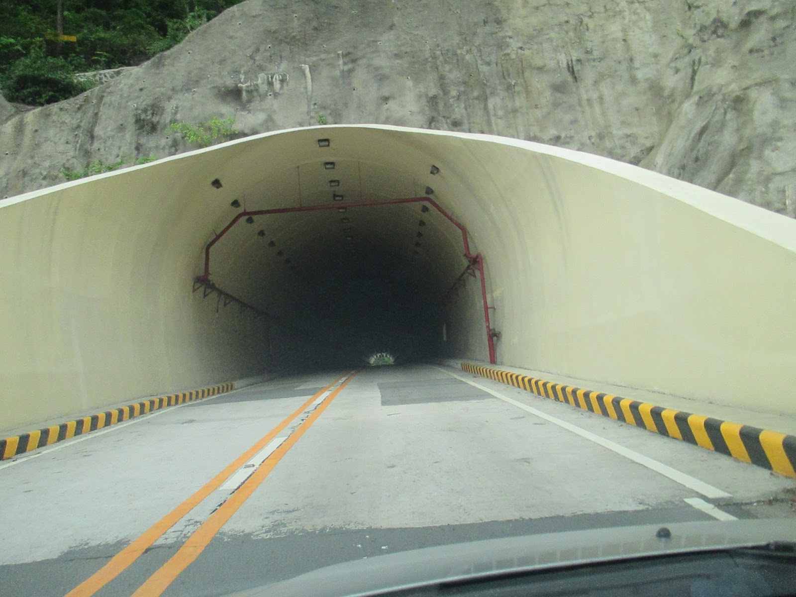
Kaybiang Tunnel connects Nasugbu, Batangas to Ternate, Cavite. The newly-built tunnel pierces through what was once an impregnable rocky mountain called Mt. Palay Palay. With a length of 300 meters, it is considered as the longest road tunnel in the Philippines. It is now a favorite destination of cyclists, bikers and travellers.
Traversing the Ternate side of the highway, with high elevation and with tall trees all around, we breezed past the junction leading to Caylabne Bay and Puerto Azul and started descending towards the populated areas of Ternate and Maragondon. We wanted to make a side trip to Mt. Nagpatong where revolutionary hero Andres Bonifacio and his brother were treacherously executed. Due to time constraints, we decided to forego as Manila was still many kilometers away. See you next time, Supremo.
- Konted
 |
| Panoramic view of Taal Lake and Taal Volcano from the ridge |
 |
| Fog envelopes a wide area of Tagaytay City. Visibility is almost zero. |
 |
| At Tagaytay Country Homes |
 |
| Breakfast at McDonald's |
 |
| Breakfast at McDonald's |
 |
| Welcome landmark at the Tagaytay-Nasugbu boundary |
 |
| Wide open space at the outskirts of the town of Lian in Batangas. This is a few kilometers away from Matabungkay. |
 |
| Rice paddies in Lian, Batangas |
 |
| Making a stopover by the side of the lonely road leading to Newport Hills and San Diego Beach. There is an abundance of Indian mangoes. |
 |
| It's Lian's fiesta. Patron saint is St. John the Baptist. |
 |
| At the town proper of Nasugbu in Batangas |
 |
| Part of the Nasugbu-Ternate Highway. There is a cluster of beach resorts here such as Punta de Fuego, Kawayan Cove, White Sand, Munting Buhangin, etc. |
 |
| Ocean view from Kawayan Cove |
 |
| Munting Buhangin Beach Resot in Nasugbu, Batangas |
 |
| A long stretch of the Nasugbu-Ternate Highway after driving downhill. |
 |
| The famed Pico de Loro Rock Monolith looms on the horizon. |
 |
| Cows grazing by the side of the road as one makes an ascent. Take note of the beautiful Fire Tree. |
 |
| A fishing village near the Nasugbu-Ternate Highway |
 |
| View of the coastline from the highway |
 |
| This is still part of Nasugbu in Batangas |
 |
| Taking our own sweet time |
 |
| Approaching Kaybiang Tunnel |
 |
| Kaybiang Tunnel connects Nasugbu, Batangas to Ternate, Cavite. |
 |
| Kaybiang Tunnel pierces through Mount Palay-Palay. |
 |
| With a length of 300 meters, it is regarded as the longest road tunnel in the Philippines. |
 |
| The Cavite portion of the highway. It leads to the towns of Ternate, Maragondon, Naic, Tanza, Noveleta and Cavite Expressway (Cavitex). |
 |
| Late, late lunch |
 |
| Late, late lunch |